

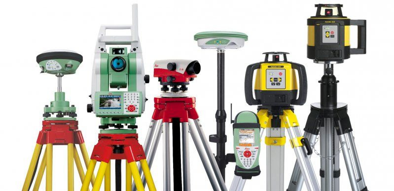
Survey and site measurement equipment is available on request as a supporting service alongside a wider EMIS package: total stations and GNSS/GPS systems for setting out, laser levels and survey accessories, and monitoring instruments where a scheme requires them. It is not a core EMIS category: where a project we are already sourcing for needs instruments, we specify each item to the stated accuracy the works demand, then coordinate the supply with calibration evidence attached.
Setting-out instruments are the familiar end of the range: total stations measuring angles and distances to millimetre precision, and GNSS receivers fixing position by satellite, corrected to centimetre accuracy for machine control and topographic work. The specification question is never which model but which accuracy class, the tolerance in the specification decides the instrument, and an instrument bought one class too low fails the works silently.
Hydrographic survey equipment extends measurement below the waterline, with echo sounders and positioning systems mapping the bed for dredging verification, scour monitoring and navigation-depth certification. Structural monitoring instruments watch what has been built or what construction might disturb, tilt sensors, crack gauges, settlement and vibration monitoring, logging movement continuously against trigger levels set by the designer.
EMIS specifies the instrument to the accuracy requirement, monitoring plan or survey specification, and sources it from vetted suppliers with calibration certificates attached at delivery. Supply, hire or a monitoring package are matched to the programme's duration, and because EMIS holds no inventory, the recommendation follows the tolerance and the terms, never a shelf.

The project types and sectors this category most often serves.
Highway, rail and structures works need total stations and GNSS matched to the specified tolerance. EMIS supplies instruments to the accuracy class with calibration evidence for the audit trail.
Dredging and berth works need bed levels proven before and after. We source hydrographic systems matched to the depth, water and required accuracy of the survey specification.
Works beside sensitive assets need continuous monitoring against designer trigger levels. EMIS supplies the instrument array with logging and calibration records ready for the checker.
Network operators need survey-grade positioning for asset capture and as-built records. On request, we source GNSS and total station equipment with the accuracy documented for the asset register.
Vetting, specification and lead-time coordination, handled before the product reaches your site.
The specification starts from the tolerance the works must hold and selects the instrument class to satisfy it, the near-right instrument fails silently, so precision is the whole job.
Calibration certificates and test evidence arrive with the instrument from vetted suppliers, so every measurement taken is defensible from day one.
Purchase, hire or a monitoring package is matched to the duration and duty, with lead times coordinated so instruments are on site when setting-out starts, not after it.
See the typical requirements we support, the challenges we help manage, and the ten-step process behind every engagement.
Tell us the requirement and the programme. You will get a specified, priced package from one accountable contact, with the category already selected on the form.
We respond to all enquiries within one business day.